Antonio Zatta (ed.): Atlante Novissimo. Illustrato Ed Accresciuto Sulle Osservazioni, E Scoperte Fatte Dai Più Celebri E Più Recenti Geografi, 4 vols., Venezia: Antonio Zatta 1779–1785, vol. 2 (1782)
Signature: Zh 300-3750/2 raro VIII
Figures: Frontispiece; Title Page; vol. 2, pl. 34 and 43
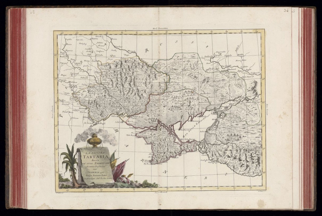
This richly colored map of the Crimean Khanate and Zaporozhosian Sich exemplifies asynchronies between the circulation of geographical knowledge and a rapidly changing political situation. While Zatta’s (fl. 1757–1797) caption does not specify the source of the map’s “new projection”, its framing decoration with standards and an incense-burner points to Paolo Santini’s (1729–1793) 1776 reprint of Gianantonio Rizzi-Zannoni’s (1736–1814) monumental map of the Black Sea. While the latter’s service rendered to the Polish court over several years helped gather a highly detailed topographical information, Zatta omits his indications of the New Russia and prioritizes “Small Tatary”. This name was used on Santini’s other sheet that derived from Robert de Vaugondy’s 1752 reprint of Joseph Delisle’s (1688–1768) 1745 map from the Russian Atlas sponsored by Saint Petersburg Academy of Sciences. While combining sources created over 30 years downplays Russian domination following the Turkish war over the Tatars and Cossacks, the ambiguity of showing Islamic-themed framing as either a panoply or a trophy corresponds to their progressive subjugation that would render the map outdated upon publication. [AM]
Link Kubikat
Link Digitized Volume