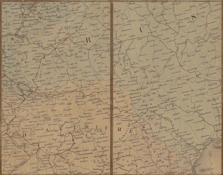
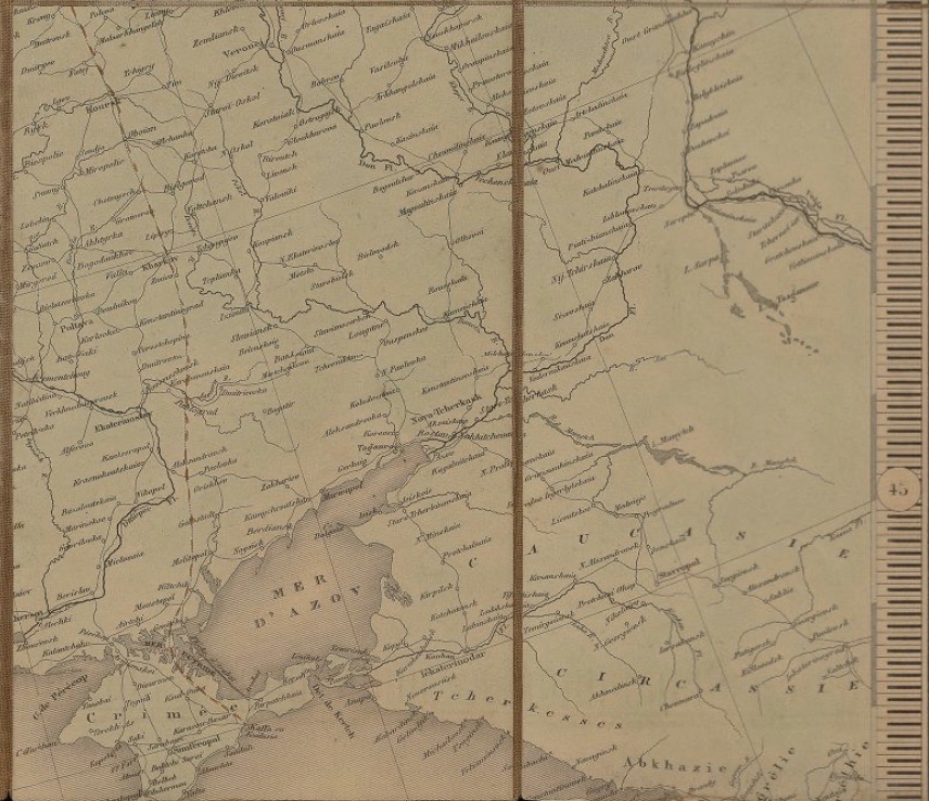
Louis É. Desbuissons: Carte des grandes voies de communication de l’Europe indiquant les chemins dee fer, les routes, les canaux et les lignes de paquebots a vapeur sul l’Océan, la Mediterraneée et la mer Noire depuis Saint Pétersburg jusqu’a Alexandrie et Odessa, Paris: Lemière 1862
Signature: Zh 305-4620 raro II
Figures: Map (recto/verso); Details
This map, drawn by French cartographer Louis Édouard Desbuissons (1827–1908), who was appointed geographer at the French Ministry of Foreign Affairs in 1865, was printed in 1862, one year after the construction of the first railroad on the modern Ukrainian territory. At a time when French diplomats were indifferent to geographical knowledge, or at least unwilling or unable to support funding for geographical office as a topic for further studies (Konvitz 1987, p. 38), Desbuissons used his spare time to familiarize himself with maps and applied his knowledge during his negotiations following the Franco-Prussian war (1870–1871).
In 1858, the imperial Privileged Society of the Galician Railways gained the concession for constructing a railway station in L’viv (Lemberg). The station building was extensively furnished – with a left luggage room and a post office, as well as waiting rooms for all classes, a café, restaurants, offices of technical services and police.
The inauguration of the station on November 4, 1861, not only connected the city to Vienna and Krakow it also integrated these territories into the European railway network, accelerating the investments inflow for the construction of new lines. Four decades later, with a growing passenger traffic, the demand for a new railway station in L’viv also grew, and its construction began in 1902. [VC]
Link Kubikat
Link Digitized Volume